 ar
ar bg
bg hr
hr cs
cs da
da nl
nl fi
fi fr
fr de
de el
el hi
hi it
it ko
ko no
no pl
pl pt
pt ro
ro ru
ru es
es sv
sv tl
tl iw
iw id
id lv
lv lt
lt sr
sr sk
sk sl
sl uk
uk vi
vi et
et hu
hu th
th tr
tr fa
fa ms
ms hy
hy ka
ka ur
ur bn
bn mn
mn ta
ta kk
kk uz
uz ku
ku
gauge water level
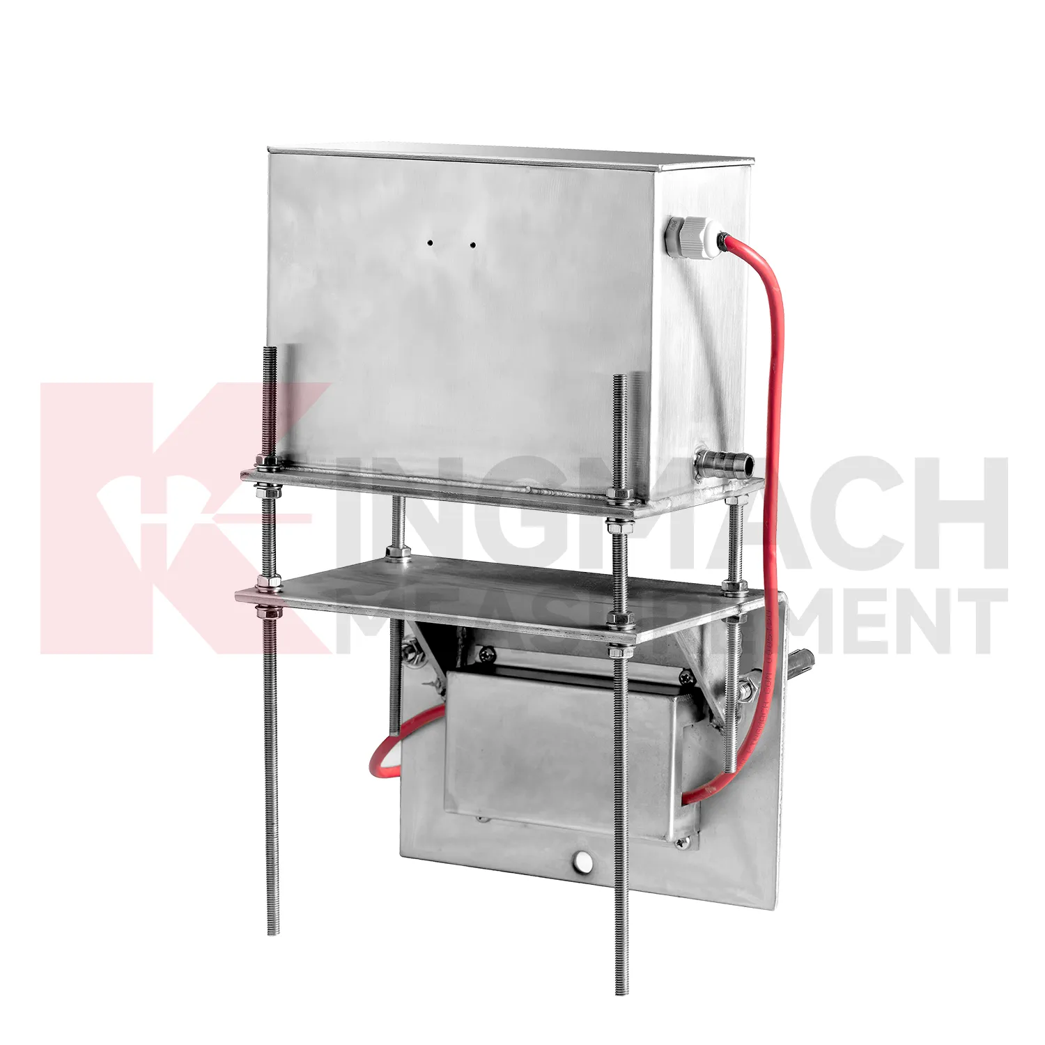
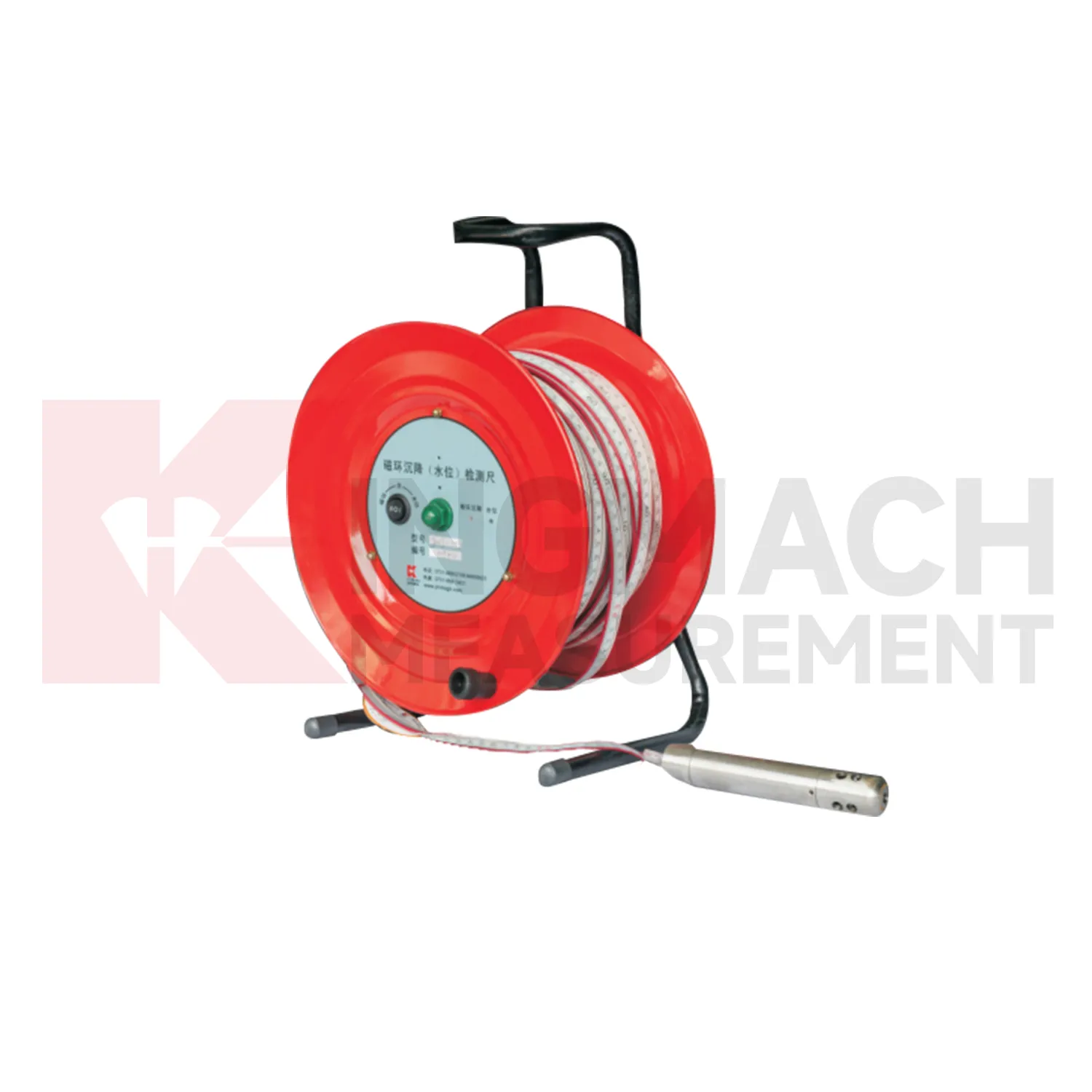
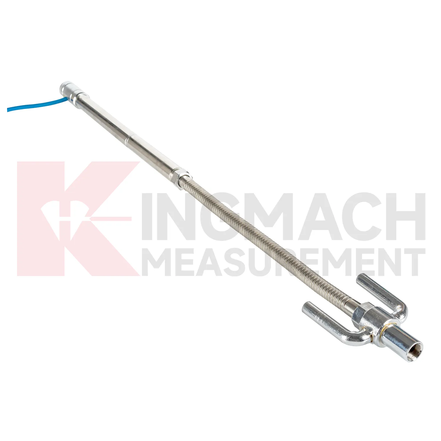
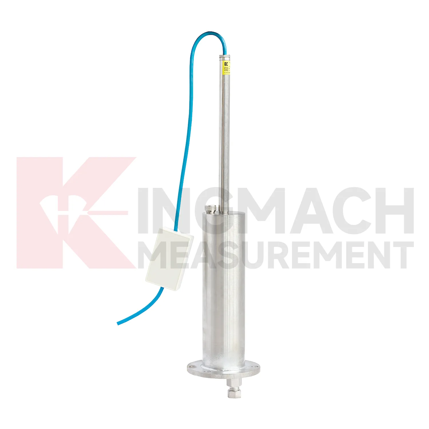
The JMCJ-1003/1005 magnetic ring settlement water level gauge gives Kingmach gauge water level a manual borehole method for layered ground. It measures underground settlement by electromagnetic induction between the probe and magnetic rings, and it measures water level by conductivity when the probe contacts groundwater. The instrument uses a probe, reel, tape, battery, audible or visual indication, and magnetic rings placed at known depths. Published depth options include 30 m, 50 m, and 100 m, with plus or minus 1 mm accuracy, 9V battery power, maximum current of 50 mA, a probe about 17 cm long and 3 cm in diameter, and -20 degrees Celsius to 60 degrees Celsius operating environment. This product is useful where the engineer needs to know which soil layer compressed, not just how much the surface moved. A careful log should keep borehole number, ring depth, water depth, reference mark, operator, weather, and construction activity together for each visit.
Application of gauge water level
In foundation pit projects, gauge water level are used during staged excavation to track base uplift, nearby pavement settlement, groundwater response, and vertical movement around retaining systems. The timing of each value matters because deformation may change after dewatering, support installation, soil removal, rainfall, or backfilling. Kingmach JMDL-47XXAT can be embedded to follow base uplift or local settlement, while JMCJ-1003/1005 can read magnetic ring depth and groundwater level in boreholes. Hydrostatic instruments may be added where several elevations around the pit need comparison against a reference. The site team should record excavation depth, support level, water pumping condition, adjacent road or building observations, and first stable baseline beside the settlement curve. If movement grows quickly, the response should include checking the sensor and reference first, then comparing support force, wall displacement, groundwater, and visual inspection before deciding whether excavation can continue. This keeps settlement review tied to the actual construction sequence, which is essential because a pit may behave differently at each excavation depth and support stage. A clear record also helps distinguish base rebound from surrounding ground loss or reference disturbance. The review file should also include reference condition, recent site work, nearby sensor behavior, and inspection notes so later teams can interpret the curve clearly.
The future of gauge water level
Future gauge water level will use smarter edge checking before data reaches the main platform. A sudden settlement jump may come from real ground movement, but it may also come from a disturbed tube, loose cable, air pocket, dewatering activity, cabinet work, or reference point change. Acquisition units can compare settlement rate, water level, rainfall, temperature, and nearby channels before marking a value as reliable. Kingmach products with RS485 output and automated acquisition compatibility already provide a basis for this kind of review. For remote railway subgrades, dams, tunnels, and slopes, early filtering can reduce unnecessary field visits while still flagging readings that need inspection. The aim is not to hide abnormal movement, but to separate data-chain faults from structural behavior faster. The practical goal is to keep settlement data understandable after the original installation crew has left, so owners can compare old and new readings without reconstructing the field history from memory. The same record should remain readable for designers, contractors, owners, and maintenance teams, because settlement monitoring often continues long after the first construction report is finished.
Care & Maintenance of gauge water level
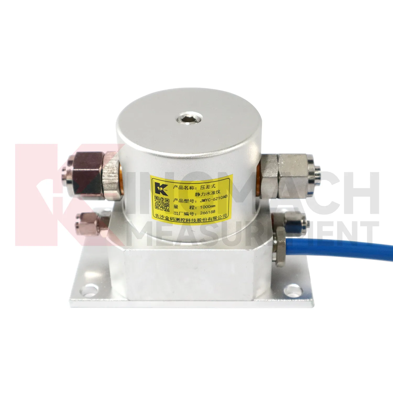
Hydrostatic gauge water level need regular checks of the liquid path. For systems using JMDL-62XXADT, JMQJ-62XXADT, or JMYC-62XXAD, inspect water pipes, connectors, sensor elevation, reference point, cabinet wiring, and tube protection. Kinks, leakage, air pockets, freezing risk, or construction damage can change the apparent settlement curve. Check whether readings change after pipe work, cabinet maintenance, or nearby excavation. For outdoor systems, protect tubes from vehicle traffic, sharp edges, workers, and animal damage. When a reading shifts suddenly, confirm the reference sensor and water path before treating the value as structural movement. Hydrostatic systems can be very useful, but they depend on a clean, continuous, well-documented connection between points. The record should include who inspected the point, what changed on site, and whether nearby instruments showed the same trend, so the maintenance team can separate sensor trouble from real settlement. The record should include who inspected the point, what changed on site, and whether nearby instruments showed the same trend, so the maintenance team can separate sensor trouble from real settlement.
Kingmach gauge water level
Layered ground behavior is another reason to use gauge water level. Kingmach JMCJ-1003/1005 magnetic ring settlement water level gauge measures underground layer settlement and groundwater level in foundations, subgrades, foundation pits, embankments, and other underground structures. Magnetic rings are installed in boreholes, and the probe emits audible and visual alerts when it senses a ring. Water level is detected through conductivity when the probe contacts water. The listed accuracy is plus or minus 1 mm, with 30 m, 50 m, and 100 m depth options. This method gives engineers a way to separate shallow settlement from deeper layer movement while also seeing water level variation. It is especially useful when soil behavior and groundwater are tied together. If the curve changes suddenly, field teams should check reference stability, cable or tube condition, recent work, and weather before treating the value as structural movement. If the curve changes suddenly, field teams should check reference stability, cable or tube condition, recent work, and weather before treating the value as structural movement.
FAQ
Q: Which gauge water level fit hydrostatic leveling?
A: JMDL-62XXADT, JMQJ-62XXADT, and JMYC-62XXAD are used for hydrostatic or differential pressure settlement monitoring.
Q: What resolution is available?
A: JMDL-62XXADT and JMQJ-62XXADT list 0.01 mm resolution, while JMYC-62XXAD lists 0.1 mm resolution for wider ranges.
Q: Where are micro range hydrostatic sensors used?
A: They are used for dam settlement, bridge deflection, slope stability, building settlement, tunnel settlement, and subgrade settlement.
Q: What protection rating is listed for JMQJ-62XXADT?
A: The product information lists IP68 protection.
Q: What can damage hydrostatic readings?
A: Leaking tubes, air pockets, poor reference control, temperature effects, cable faults, and disturbed sensor elevations can all affect the record.
Reviews
Joshua Clark
We ordered a full monitoring solution including sensors and data loggers. Everything works seamlessly together. Great supplier!
Michael Anderson
The strain gauges and load cells are extremely accurate and stable. They performed very well in our bridge monitoring project. Highly recommended!
Latest Inquiries
To protect the privacy of our buyers, only public service email domains like Gmail, Yahoo, and MSN will be displayed. Additionally, only a limited portion of the inquiry content will be shown.
Charlotte***@gmail.comUnited Arab Emirates
Hi, we require instrumentation cables suitable for harsh environments. Could you advise on specifica...
Olivia***@gmail.comUnited States
Hello, we are currently sourcing high-precision strain gauges and load cells for a bridge monitoring...
Related product categories
- Wide-Range Differential Pressure Hydrostatic Level Sensor
- Inductive Frequency-Modulated Hydrostatic Level Sensor
- water level gauge
- water gauge water level gauge
- water gauge level
- gauge water level
- Magnetic Ring Settlement Water Level Gauge
- Optical Deflection Monitor
- Tilt Sensor
- Deflectometer
- Micro Range Hydrostatic Level Sensor
- Single-point Settlement Meter